Select language

Saltar al contenido

Human Development &
Capability Association

Multi-Disciplinary and People-Centred

  • Type

  • Thematic group

  • Region

  • Search

  1. The State of the Union: Reflections on Democracy and Division in and beyond the United States of America
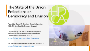
    …e supremacy, and toxic masculinity. These forces converged in a literal attack on democracy during an insurrection at the Capitol building in Washington, DC on January 6, 2021. More globally, a recent “democratic recession” seems to have halted if not reversed the third wave of democratization (Diamond 2015), and everywhere there are signs of the deterioration of political rights and civil liberties (Abramowitz 2018), the erosion of citizens’ trus…

    HDCA Webinar North American Network HDCA Videos
    90 minutes
  2. Politics of Wonder: Difference and Dignity in Nature and Society (University of Exeter, UK)

    …es are very welcome. Attendance is free, but space is limited – please contact Jack Griffiths (j.griffiths3@exeter.ac.uk) to register, or for more information. Confirmed speakers Prof. Jeremy Bendik-Keymer (Case Western Reserve University, Ohio, USA) Prof. Amy Linch (Pennsylvania State University, USA) Dr. Urszula Lisowska (University of Wrocław, Poland) Prof. Christopher Gill (University of Exeter, UK) Dr. Jack Griffiths (University of Exeter, UK…

  3. Overview of Past HDCA Conferences and Global Dialogue

    …2008 – India, New Dehli: Equality, Inclusion and Human Development 2007 – USA, New York: Ideas Changing History 2006 – the Netherlands, Groningen: Freedom and Justice 2005 – France, Paris: Knowledge and Public Action 2004 – Italy, Pavia: Enhancing Human Security (Conferences that preceded the founding of the HDCA): 2003 – Italy, Pavia From Sustainable Development to Sustainable Freedom 2002 – UK, Cambridge Promoting Women’s Capabilities: Examinin…

  4. 1) Abbas, A., Khan, S., Hussain, N., Hanjra, M. A. and Akbar, S. (2013). Characterizing soil salinity in irrigated agriculture using a remote sensing approach’. Physics and Chemistry of the Earth, 55, pp. 43-52. 2) Anderson, J.R., Hardy, E.E., Roach, J.T., and Witmer, R.E., (1976); A Land Use and Land Cover Classification System for Use with Remote Sensor Data, United States Government Printing Office, Vvashington, V 1, pp. 1-27. 3) Barnsley, M. J., & Barr, S. L. (1996). Inferring urban land use from satellite sensor images using kernel based spatial reclassification. Photogramm Eng Remote Sensing, 62(8), 949–958. 4) Brahabhatt, V.S., Dalwadi, G.B., Chhabra, S.B., Ray, S.S., & Dadhwal, V.K., 2000. Landuse/land cover changes mapping in Mahi canal command area, Gujarat, using multitemporal satellite data, J.Indian Soc. Remote Sensing. 28(4), pp 221-232. 5) David,K., Yetta, G., Agung, F., Sharon, H.,& Alison, C.(2016). Land use planning for disaster risk reduction and climate change adaptation: Operationalizing policy and legislation at local levels. International Journal of Disaster Resilience in the Built Environment, 7(2), 158–172. 6) DCHB (District census Handbook) http://censusindia.gov.in/2011census/dchb/DCHB_A/19/1917_PART_A_DCHB_SOUTH%20TWENTY%20FOUR%20PARGANAS.pdf 7) Diallo, Y., Hu, G., & Wen, X. (2009). Applications of remote sensing in land use/land cover change detection in Puer and Simao Counties, Yunnan Province. Journal of American Science, 5(4), 157–166. 8) Duke, N.C., Meynecke, J.O., Dittmann, S., Ellison, A.M., Anger, K., Berger, U. (2007) “A World Without Mangroves?” Science, 317, 41–42. 9) Erener, A., Du ¨zgu ¨n, S., & Yalciner, A. C. (2012). Evaluating land use/cover change with temporal satellite data and information systems. Procedia Technology, 1, 385–389. 10) Erener, A., Du ¨zgu ¨n, S., & Yalciner, A. C. (2012). Evaluating land use/cover change with temporal satellite data and information systems. Procedia Technology, 1, 385–389. 11) Foody, G. M. (2002). Status of land cover classification accuracy assessment. Remote Sensing of Environment, 80(1), 185–201. 12) Friess, A.D., Scales, I. R., Glass, L., and Ravaoarinorotsihoarana, L., (2016) “Rural livelihoods and mangrove degradation in south-west Madagascar: lime production as an emerging threat”, Fauna & Flora International, pp-1-5. 13) Gao, Y., & Zhang, W. (2009). LULC classification and topographic correction of Landsat-7 ETM ? imagery in the Yangjia River Watershed: The influence of DEM resolution. Sensors, 9(3), 1980– 1995. 14) Gautam, N.C.,& Narayanan, L.R.A., 1983. Landsat MSS data for land use/land cover inventory and mapping: A case study of Andhra Pradesh, J.IndianSoc, Remote Sensing, 11(3), pp 15-28. 15) Giri, C. & Muhlhausen, J. (2008) “Mangrove Forest Distribution Sand Dynamics In Madagascar (1975 – 2005)”, Sensors, vol-8, pp.2104 –2117. 16) Guler, M., Yomralıoglu, T., & Reis, S. (2007). Using landsat data to determine land use/land cover changes in Samsun, Turkey. Environmental Monitoring and Assessment, 127(1–3), 155–167. 17) Guler, M., Yomralıoglu, T., & Reis, S. (2007). Using landsat data to determine land use/land cover changes in Samsun, Turkey. Environmental Monitoring and Assessment, 127(1–3), 155–167. 18) Gumma, M. K., Thenkabail, P. S., Hideto, F., Nelson, A., Dheeravath, V., Busia, D., et al. (2011). Mapping irrigated areas of Ghana using fusion of 30 m and 250 m resolution remote-sensing data. Remote Sensing, 3(4), 816–835. 19) Hegazy, I. R., and Kaloop, M. R. (2015). Monitoring urban growth and land use change detection with GIS and remote sensing techniques in Daqahlia governorate Egypt. International Journal of Sustainable Built Environment, 4(1), 117–124. 20) Helmer, E. H., Brown, S., & Cohen, W. B. (2000). Mapping montane tropical forest successional stage and land use with multi-date Landsat imagery. International Journal of Remote Sensing, 21(11), 2163–2183. 21) Herold, M., Scepan, J., & Clarke, K. C. (2002). The use of remote sensing and landscape-metrics to describe structures and changes in urban land uses. Environment and Planning A, 34(8), 1443– 1458. 22) Jain, S.K., 1992. Land use mapping of Tawi catchment using satellite data. Report No.CS72, National Institute of Hydrology, Roorkee, 52. 23) Jayakumar, S., and Arockiasamy, D. (2003), ‘Land use land cover mapping and change detection in part of Eastern Ghats of Tamil Nadu using remote sensing and GIS’, Journal of Indian Society of Remote Sensing 31, 251–260. 24) Jensen, J. R. (2007). Remote sensing of the environment (2nd ed.). Upper Saddle River: Pearson Prentice Hall. 25) Ji, W., Ma, J., Twibell, R. W., & Underhill, K. (2005). Characterizing urban sprawl using multistage remote sensing images and landscape metrics. Computers, Environment and Urban Systems, 30(2006), 861–879.3 26) Jia, K., Wei, X., Gu, X., Yao, Y., Xie, X., & Li, B. (2014). Land cover classification using Landsat 8 Operational Land Imager data in Beijing, China. Geocarto International, 29(8), 941–951. 27) Kumar, R. (2016). Flood hazard assessment of 2014 floods in Sonawari sub-district of Bandipore district (Jammu & Kashmir): An application of geoinformatics. Remote Sensing Applications: Society and Environment, 4, 188–203. 28) Lambin, E. F., Turner, B. L., Geist, H. J., Agbola, S. B., Angelsen, A., Bruce, J. W., et al. (2001). The causes of land-use and land-cover change: Moving beyond the myths. Global Environmental Change, 11(2), 261–269. 29) Liu, T., and Yang, X. (2015). Monitoringland changesin anurban area using satellite imagery, GIS and landscape metrics. Applied Geography, 56, 42–54. 30) Loveland T. R., & Acevedo W. (2006) Land cover change in the Eastern United States, US Geological survey. 31) Lu, D., & Weng, Q. (2004). Spectral Mixture Analysis of the Urban Landscape in Indianapolis with Landsat ETM ? Imagery. Photogrammetric Engineering and Remote Sensing, 70(9), 1053– 1062. 32) Lu, D., Hetrick, S., Moran, E., & Li, G. (2012). Application of time series landsat images to examining land-use/landcover dynamic change. Photogrammetric Engineering and Remote Sensing, 78(7), 747–755. 33) Malakar, K.D., (2020). The Mangrove: Future of the Global seacoast. Globe edit, Germany, ISBN: 978-620-0-60757-7. 34) Map Library (MAP) (2000) (http://www.maplibrary.org/library/stacks/Africa/Madagascar/Mahajanga/Mahajanga%20Urban/index.htm) 35) Nelson, F. (1983). Detecting forest canopy change due to insect activity using Landsat MSS. Photogrammetric Engineering and Remote Sensing, 49(9), 1303–1314. 36) Ojima, D. S., Galvin, K. A., & Turner, B. L. (1994). The global impact of land-use change. BioScience, 44(5), 300. 37) Quintas-Soriano, C., Castro, A. J., Castro, H., & Garcı ´a-Llorente, M. (2016). Impacts of land use change on ecosystem services and implicationsfor human well-being in Spanish drylands. Land Use Policy, 54, 534–548. 38) Seto, K. C., & Kaufmann, R. K. (2005). Using logit models to classify land cover and land-cover change from Landsat Thematic Mapper. International Journal of Remote Sensing, 26(3), 563–577. 39) Shah, S. A. (2012). Use of geographic information system in land use studies: A micro level analysis. European Journal of Applied Sciences, 4(3), 123–128. 40) Sharma, K.R., Jain, S.C., &Garg, R.K, 1984. Monitoring land use and land cover changes using landsat imager, J. Indian Soc. Remote Sensing 12(2), pp 115-121. 41) Singh, A. (1989). Review article digital change detection techniques using remotely-sensed data. International Journal of Remote Sensing, 10(6), 989–1003. 42) Turner, B. L., Moss, R. H., & Skole, D. L. (1993). Relating land use and global land-cover change. In Unknown host publication title. International geosphere-biosphere programme, Stockholm; Report, 24/human dimensions of global environmental change programme, Barcelona; Report 5. 43) UNEP (2014) “The Importance of Mangroves: A Call to Action”, United Nations Environment Programme– World Conservation Monitoring Centre, Cambridge, UK. 44) World Conservation Monitoring Centre (WCMC) https://www.unep-wcmc.org/ 45) Yang, X. (2002). Satellite monitoring of urban spatial growth in the Atlanta metropolitan area. Photogrammetric Engineering and Remote Sensing, 68(7), 725–734. 46) Yang, X., & Liu, Z. (2005). Using satellite imagery and GIS for land-use and land-cover change mapping in an estuarine watershed. International Journal of Remote Sensing, 26(23), 5275–5296.

  5. Call for Abstracts: International Indigenous Development Research Conference 2014

    …evelopment2014.ac.nz All Abstracts will be assessed by the Conference Abstract Committee. There is potential for a limited number of panel presentations, please contact us as soon as possible if you are interested in convening a panel. There will be a published, reviewed conference proceedings and all accepted authors will be invited to submit their full paper to the conference proceedings. Important Dates Abstract Submission open: February 2014 A…

  6. The right to science | UN general comment | Ideas for collaboration

    …ntact me in case you want to join and ‘meet us’ online. I hope some of you will: we need bright minds willing to spend some of their time in promoting the ‘right to science’ beyond standard academic activities. We feel the responsibility to do it, and to do it now. We’ll be glad to tell you more. Claudia Basta: c.basta@sciencefordemocracy.org…

scroll to top